iHunter Yukon Pro Subscription
The iHunter Yukon Pro subscription adds 11 additional map layers including: Crown Land, Surveyed Land, Coommunities, Agricultural Land Dispositions, Outfitting Areas, Trapping Concessions, ORV Trail Plans, ORV Restrictions, Forestry Roads, Road Network, and Trails.
To use these layers on your map, first make sure you have iHunter YT:


Then either try it free for 7 days or subscribe for only $14.99 per year to benefit from the layers being updated annually.
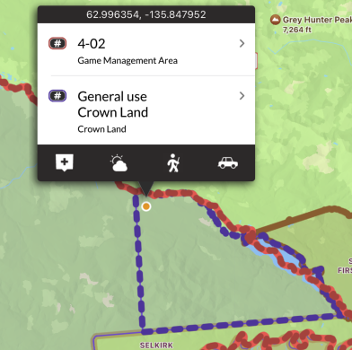
Crown Land
By taking the land boundaries of the Yukon and subtracting out the boundaries of all surveyed land, parks, and reserves, leases, and communities, we derived the ‘Crown Land’ layer. There may be additional access and discharge restrictions on this land that are not documented in openly available GIS layers, and it is the user’s responsibility to obey all posted restrictions in the field. Although we have done our best to ensure this is accurate, discrepancies may exist. This layer should be used as a guideline only.
These areas are shown in purple on the map, and are built into the app. They can be used even without cell coverage.
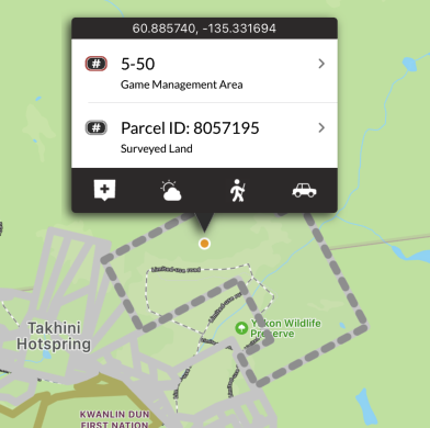
Surveyed Land
Surveyed Land Parcels are real property objects that represent the spatial extent of a lot or parcel of land against which rights and interests may be registered. Land Parcel with a parcel status of ‘Active’ form the current cadastral fabric.
These areas are shown in grey on the map, and are built into the app. They can be used even without cell coverage.
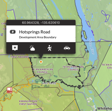
Communities
This layer is made up of several community boundaries including: Municipal, Development Area Regulations, Land Claims Final Agreement, Self Government Agreement, Memorandum of Understanding, Local Area Plans, and Community Plans.
These areas are shown in dark grey on the map, and are built into the app. They can be used even without cell coverage.
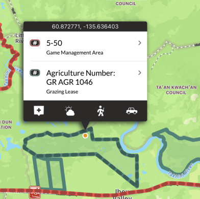
Agricultural Land Dispositions
This layer includes land under administration and control of Government of Yukon, Department of Energy, Mines and Resources (EMR), or Agriculture Branch. It includes all dispositions of agricultural land.
These areas are shown in teal on the map, and are built into the app. They can be used even without cell coverage.
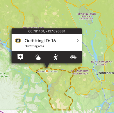
Outfitting Areas
This layer displays outfitting concessions (OCs) which are also known as Outfitting Areas. They are legal boundaries that define an area where the holder of the concession has the exclusive right to outfit non-residents for the purpose of hunting big game animals (excepting special guiding licenses). If a non-resident wishes to hunt in the Yukon they must do so accompanied by a Yukon resident–either a private individual who does this for free, or a commercial operator who does this as a business (an outfitter). Each outfitter is licensed to operate within a particular OA. There are 20 such concessions in the Yukon–one per licensed outfitter. OCs are largely (but not always) defined by groupings of Game Management Areas. There are several areas within the Yukon (exclusive of National Parks) which are not covered by OCs.
These areas are shown in orange on the map, and are built into the app. They can be used even without cell coverage.
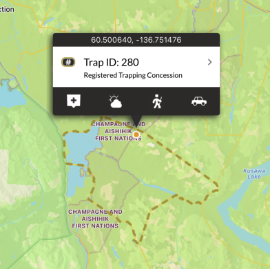
Trapping Concessions
This layer displays registered trapping concessions (RTCs). They are legal boundaries that define an area where the holder of the concession has the exclusive right to trap furbearing animals. Because trapping is done primarily along waterways, RTCs are often defined by watersheds, using height of land (ridges and mountain peaks) as their boundaries. This is the opposite of GMAs which are defined by mountains. Sometimes RTCs are grouped together to form a Group Trapping Concession (in which groups of individual share the right to trap). This may or may not involve the elimination of the component RTC boundaries. The Yukon has 360 RTCs and 13 Group Trapping Concessions. Only Kluane National Park, Kluane Wildlife Sanctuary, and Ddhaw Ghro Habitat Protection are are not covered by RTCs.
These areas are shown in yellow on the map, and are built into the app. They can be used even without cell coverage.
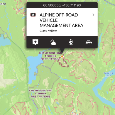
Off-road Vehicle Restrictions
ORV management areas are designate areas where off-road vehicle use is managed for the protection of ecological balance or physical characteristics within the area, including on mineral claims and in territorial parks. Off-road vehicle management areas can result from recommendations coming out of public planning processes, such as regional land-use planning, local area planning and special management areas such as Habitat Protection areas or parks. Governments and other groups, such as the Fish and Wildlife Management Boards and Renewable Resource Councils can submit a proposal that identifies ecologically-sensitive areas that off-road vehicle management areas could protect. This layer should be used in conjunction with the ORV Trail Plans that shows trails found within these boundaries.
These areas are shown in pink on the map, and are built into the app. They can be used even without cell coverage.
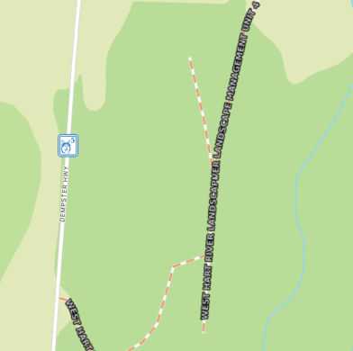
Off-road Vehicle Plans
This layer contains dashed line segments representing off road vehicle (ORV) trail plans. It shows the trails within the off-road vehicle management area or part of the off-road vehicle management area for which a trail plan is developed, on which an off-road vehicle may be used. There are labels describing whether an ORV is permitted, prohibited, or prohibited except where designated by an approved Off Road Management Area Trail Plan.
These areas are shown as pink dashed lines on the map, and are not built into the app. Each time a new area of the map is viewed, or a new zoom level is looked at, that portion of the layer needs to be downloaded (requiring cell or Wifi service). Once downloaded, those tiles are cached on device for future offline use.
Forestry Roads
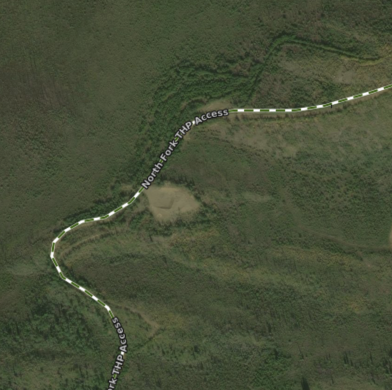
This layer contains road segments that are the linear geometry of the road. It consists of forest resource roads (FRR) that are actively used for accessing forest resources. These roads do not represent a complete road network, they should be viewed in conjunction with the Roads Network layer. Many FRRs are gated with controlled access. There are four categories of roads in the dataset: Forest Resource Roads (act); Forest Resource Access (non-act), Public Access (non-act) and auxiliary roadsroads.
These areas are shown as green dashed lines on the map, and are not built into the app. Each time a new area of the map is viewed, or a new zoom level is looked at, that portion of the layer needs to be downloaded (requiring cell or Wifi service). Once downloaded, those tiles are cached on device for future offline use.
Yukon Road Network
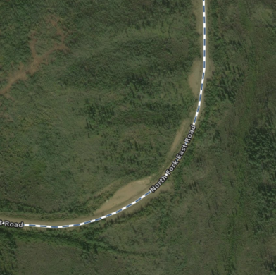
The Yukon Road Network is the authoritative source of road data for Yukon. This dataset represents road centrelines for road features administered by Government of Yukon. Road features not administered by Government of Yukon are supplied by Canvec Road Network.
These areas are shown as navy blue dashed lines on the map, and are not built into the app. Each time a new area of the map is viewed, or a new zoom level is looked at, that portion of the layer needs to be downloaded (requiring cell or Wifi service). Once downloaded, those tiles are cached on device for future offline use.
Trails
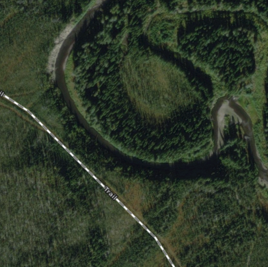
The Yukon Trail network displays transportation features including limited-use roads, cutlines, and trails.
These areas are shown as grey dashed lines on the map, and are not built into the app. Each time a new area of the map is viewed, or a new zoom level is looked at, that portion of the layer needs to be downloaded (requiring cell or Wifi service). Once downloaded, those tiles are cached on device for future offline use.